
Beleriand: The Lost Land of Elves and Epic Legends
Unraveling the Mysteries and Legends of Tolkien's Forgotten Realm
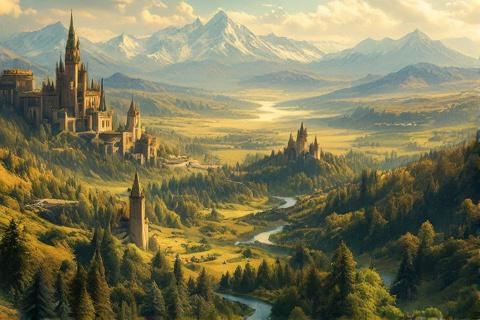
The Geographic Expanse of Beleriand
Beleriand was a vast region that extended from the shores of Belegaer, the Great
Sea, in the west to the towering Blue Mountains (Ered Luin) in the east. This
expansive land served as the westernmost portion of
Middle-earth during the First Age,
becoming the primary setting for many of the greatest tales in The
Silmarillion. The realm contained diverse landscapes
ranging from dense forests to rolling plains and steep highlands.
The formidable mountain ranges of the Ered Wethrin (Mountains of Shadow) and
Ered Engrin (Iron Mountains) formed Beleriand's northern frontier. These peaks
served as natural barriers against the frozen wastes of Dor Daedeloth and the
icy realm of Morgoth. The Mountains of Shadow curved from
the west like a great sword, while the Iron Mountains stretched across the north
like an impenetrable wall.
The sheer scale of Beleriand was immense, spanning approximately 600 miles from
the Great Sea to the Blue Mountains and extending roughly 500 miles from north
to south. This vast territory encompassed an area comparable to modern-day
France, providing home to various peoples including Sindar and
Noldor Elves, Men of the Three Houses of the
Edain, and Dwarves who dwelt in the Blue Mountains. The land's
size and diversity allowed for the establishment of numerous realms and kingdoms
throughout the First Age.
The Great Rivers of Beleriand
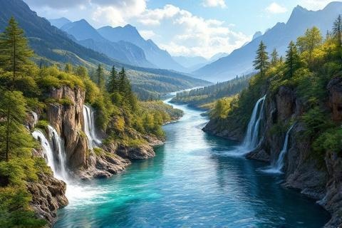
The River Sirion, mightiest of all the waters of Beleriand, carved its path
through the heart of the realm from its sources in the Mountains of Shadow to
its delta at the Bay of Balar. The river's importance to Beleriand cannot be
overstated, as it served not only as a crucial geographical feature but also as
a lifeline for many settlements and a natural boundary between various realms.
Its waters flowed through deep gorges and broad vales, including the famous Pass
of Sirion.
The Gelion River defined Beleriand's eastern territories, flowing southward
along the Blue Mountains through East Beleriand. This mighty river had its
origins in two sources: the Greater Gelion, which sprang from Mount Rerir, and
the Little Gelion, which flowed from the Hill of Himring. The river's course
marked the boundary between Beleriand proper and the eastern lands of Thargelion
and Ossiriand.
A complex network of tributaries fed these major rivers, creating a rich
watershed throughout Beleriand. The River Narog, which flowed past the hidden
stronghold of Nargothrond, joined the Sirion from the
west. The Teiglin wound through the Forest of Brethil before meeting the Sirion,
while the Esgalduin flowed through Doriath, earning its name
as the 'River Under Shadow.' These waterways shaped the political and cultural
boundaries of the various Elven realms while providing vital resources to their
inhabitants.
The Great Forests
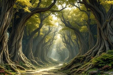
Doriath, the hidden kingdom of King Thingol and Queen
Melian, was centered around the ancient Forest of Region
and Neldoreth. The realm was famously protected by the Girdle of Melian, an
impenetrable maze of shadows and bewilderment created by the Maia
Melian's power. This enchantment kept Doriath safe from enemies for centuries,
allowing it to become the most powerful and culturally sophisticated of the
Sindarin realms in Beleriand.
The Forest of Region spread across the southern portions of Doriath, its dense
canopy providing shelter to countless Sindarin Elves. This ancient woodland was
home to many of the first trees of Middle-earth and was particularly noted for
its ancient stands of oak and beech. The forest floor was perpetually dim,
creating an atmosphere of mystery and ancient power that perfectly suited its
role as part of Thingol's realm.
Along the western borders of Beleriand stood the Forest of Brethil, home to the
Folk of Haleth, one of the Three Houses of the Edain. This woodland realm
bordered the lands of Nargothrond and lay between the Rivers Teiglin and Sirion.
The Men who dwelt there maintained a crucial alliance with the Elves of Doriath,
helping to guard the northern approaches to Nargothrond while maintaining their
independence under their own chieftains.
The Hidden Realms
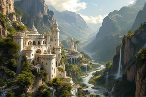
The hidden city of Gondolin, built by Turgon of the Noldor,
lay concealed within the Echoriath or Encircling Mountains. This secret realm
was crafted to resemble Tirion upon Túna in Valinor and
remained hidden from friend and foe alike for nearly four hundred years. The
only entrance to the valley of Tumladen, where Gondolin stood, was through a
secret tunnel called the Hidden Way, making the city virtually impregnable until
its eventual betrayal.
Nargothrond, the underground fortress-city established by Finrod
Felagund, was delved into the high banks of the
River Narog. This magnificent stronghold was inspired by Menegroth but surpassed
it in size and might. The fortress featured vast halls, armories, and living
quarters connected by intricate tunnels and passages, all hidden beneath the
hills of Taur-en-Faroth, the High Faroth or Hills of the Hunters.
Menegroth, known as the Thousand Caves, was the capital of Doriath and the
greatest of all underground realms in Beleriand. Crafted with the aid of the
Dwarves of Belegost, its halls were adorned with countless carved pillars and
intricate stonework depicting trees, birds, and beasts. The caves were
illuminated by countless lamps, and their walls were decorated with tapestries
woven by Melian and her maidens, depicting the history of Arda.
The Falas and Western Shores
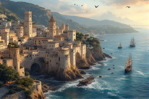
The twin havens of Brithombar and Eglarest, built by the Falmari Elves, stood as
vital ports along Beleriand's western coast. These harbors served as crucial
links between the realms of Beleriand and the island kingdom of the
Teleri in Valinor before the changing of the world. The havens
were fortified with strong walls and towers, providing safe harbor for ships and
serving as important centers of trade and communication.
The Bay of Balar formed a vast inlet where the waters of the River Sirion met
the Great Sea in southwestern Beleriand. This bay was created during the War of
the Powers when the western portions of Beleriand were broken and drowned. The
waters of the bay were relatively protected from the tumultuous seas beyond,
making it an ideal location for havens and ports.
Rising from the waters of the Bay of Balar was the Isle of Balar, a remnant of
the larger island that had been broken off from Tol Eressëa in ancient times.
This island became a refuge for survivors of the various battles and defeats in
Beleriand, particularly after the Fall of the Falas. Under the leadership of
Círdan the Shipwright, it served as one of
the last havens of the Elves in Beleriand until the War of
Wrath.
The Northern Highlands
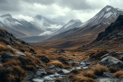
Hithlum was a highland region bounded by the Mountains of
Shadow to the north and east, with the sea forming its western border. This cold
but fertile land was initially settled by the Noldor under
Fingolfin and became one of the strongest realms
opposing Morgoth. The region's natural defenses and strategic location made it a
crucial buffer against the forces of Angband, though it
eventually fell to the Enemy after the Nirnaeth Arnoediad.
Within Hithlum lay the plateau of Dor-lómin, a high-lying
land in its southeastern portion. This region became the home of the House of
Hador, the Third House of the Edain, who were granted the land in fief by the
High King Fingolfin. The hardy people of this house thrived in the cool climate,
building a proud kingdom that produced many great heroes, including Húrin and
Huor.
Nevrast, the westernmost portion of Hithlum, occupied the coastal region between
the Mountains of Shadow and the sea. This land was initially the dwelling place
of Turgon and his people before they departed to build the hidden city of
Gondolin. The region was marked by the great mountain of Taras near the coast
and the freshwater lake of Linaewen at its center. Though eventually abandoned
by the Noldor, Nevrast remained one of the most beautiful regions of Beleriand,
with its mixture of mountain, shore, and fertile plains.